

Transforming Urban Complexity: How GeoSpatial AI & Digital Twins Are Solving Bangkok’s Traffic and Flood Challenges
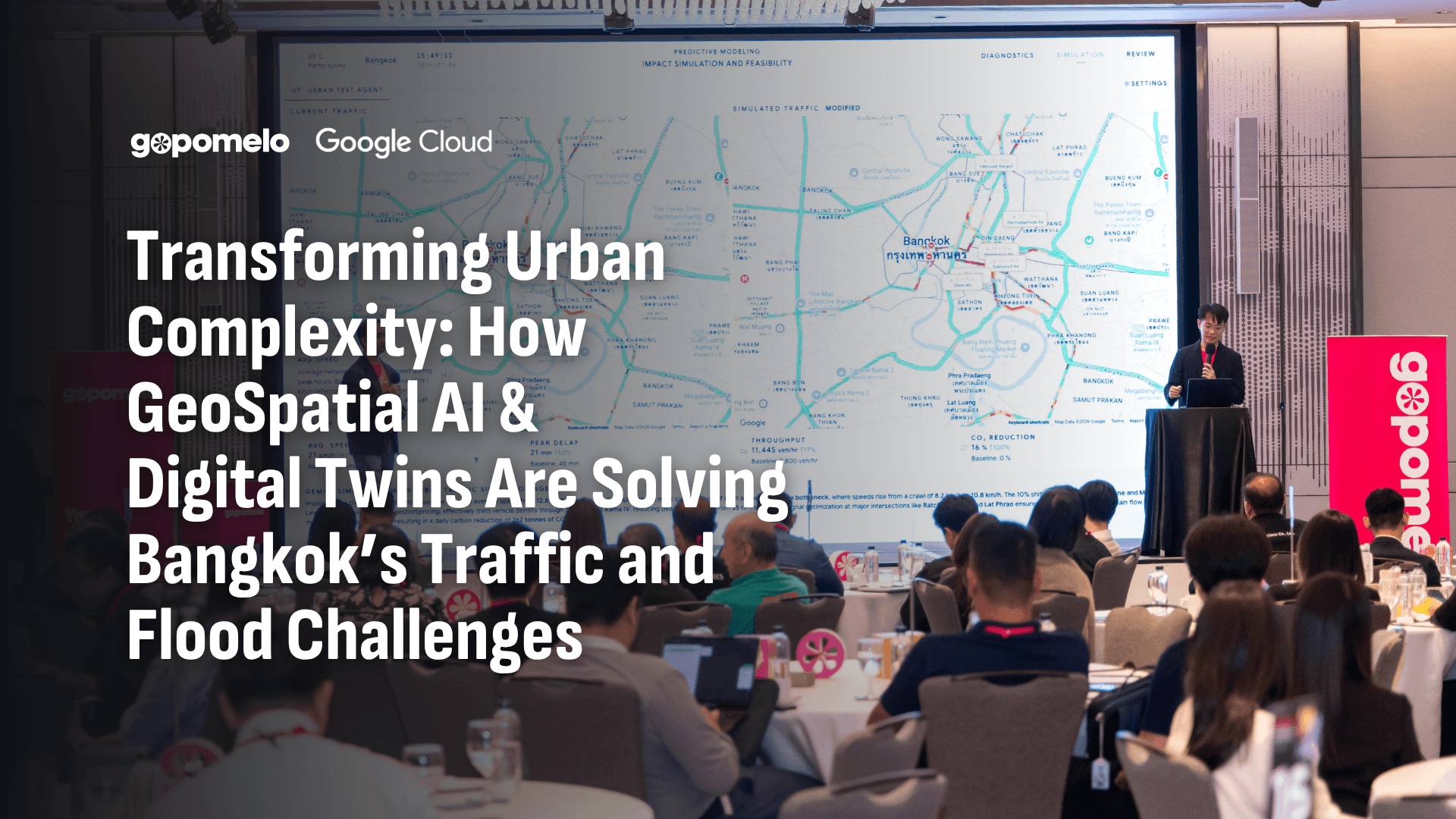
Highlights from the GoAgentic Event by GoPomelo & Google Cloud
Every city resident knows the frustration: you leave the office at 5:00 PM, expecting a routine commute, only to find yourself trapped in three hours of bumper-to-commuter traffic. Add a sudden downpour with lingering floodwaters, and an entire metropolis can ground to a halt.
At the recent GoAgentic event, GoPomelo demonstrate that urban gridlock and flash floods aren't an inevitable fate. Presenting a live demonstration on stage, Pattawee Srisongkram and Sarun Wonganankanok unveiled the GeoSpatial AI Platform (Urban Analytics & Digital Twin Platform)—a solution designed to unify city data, simulate urban policy decisions before spending capital, and orchestrate real-time responses.
Here is an inside look at how GeoSpatial AI is reshaping smart city management.
The Urban Challenge: Data Silos and Reactive Management

Cities generate vast amounts of data every second—from CCTV feeds and IoT traffic sensors to water level gauges and meteorological reports. However, most municipalities face a critical bottleneck: Data Silos.
When traffic data lives on one system, flood monitoring on another, and public transit schedules on a third, decision-makers are forced into a reactive posture. Emergency responses get delayed, and infrastructure investments become guesswork.
To move from reactive fire-fighting to proactive city management, urban planners need two things:
A Single Source of Truth: Bringing disconnected data sources into a unified data warehouse.
Intelligent Automation: AI systems capable of analyzing complex spatial datasets in real time and proposing actionable solutions.
The Solution Architecture: Google Cloud & Multi-Agent AI
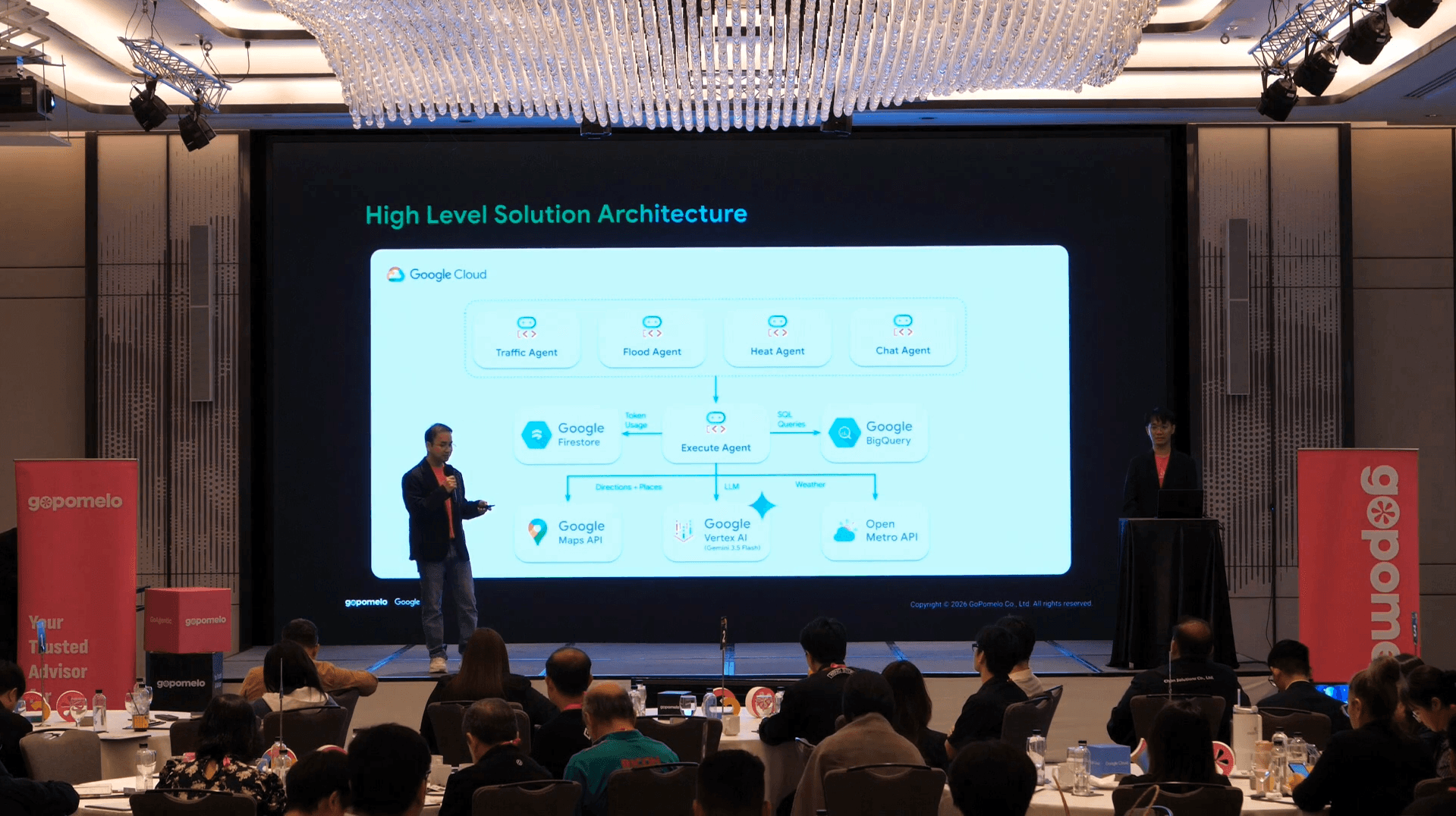
Built natively on Google Cloud Platform, the GeoSpatial AI architecture leverages BigQuery for centralized data warehousing and Google Maps API for spatial visualization.
At the heart of the platform sits a Master Execute Agent powered by Gemini 1.5 Flash, orchestrating a team of specialized AI agents:
Traffic Agent: Monitors live congestion hotspots, calculates average delay times, and pinpoints root causes (such as illegally parked vehicles or bus lane blockages).
Flood Agent: Tracks water level sensors, rainfall volume, and drainage station capacities to highlight inundation risks.
Heat Agent: Evaluates urban heat island effects across metropolitan zones.
Chat Agent: Provides a natural language interface (supporting Thai, English, and other languages) so decision-makers can query city status directly.
Real-Time Ranking & Root-Cause Drill-Down
During the live demonstration, the platform continuously aggregated mock data representing real-world Bangkok sensors.
Rather than overwhelming operators with raw figures, the system automatically ranked districts by severity. For example, the Watthana District was flagged with a critical average travel delay of +52 minutes.
With a single click, operators could drill down into the specific corridor near Asok Station and Terminal 21. The AI immediately identified the underlying issue: heavy evening rush-hour pedestrian traffic combined with curb-side parking that effectively stripped away an entire traffic lane.
Instead of just reporting the issue, the AI offered instant recommendations: clear stalled buses from active lanes and trigger digital roadside signage directing drivers toward Phetchaburi Road.
"Test Before You Invest" via AI Impact Simulation

Urban infrastructure projects demand massive capital—whether it is adding lanes, building drainage tunnels, or implementing congestion pricing. Historically, city planners had to spend the money first before knowing if a solution would work.
GeoSpatial AI solves this with Simulation Mode.
In the GoAgentic demo, the team ran a live simulation scenario:
Added two virtual lanes along Sukhumvit Corridor.
Shifted 10% of private car commuters to public transit.
Optimized traffic signal timing by 50% using AI control.
Applied a nominal congestion toll (25 THB) during rush hour.
The Simulated Results:
Average Speed: Increased from 19 km/h to 27 km/h (+42%).
Peak Traffic Delay: Dropped from 31 mins to 21 mins (-53%).
Throughput Capacity: Rose to 11,445 vehicles/hour.
Carbon Footprint: Reduced CO2 emissions by 16%.
By running virtual experiments, city leaders can evaluate policy outcomes, optimize budget allocation, and minimize public backlash before laying a single brick.
Grounded Intelligence & Human-in-the-Loop Workflows

A common hesitation with AI adoption in public sector environments is the risk of "hallucination"—AI generating unverified facts.
GeoSpatial AI enforces strict Data Grounding. Every insight provided by the Chat Agent is linked to underlying data sources, such as specific CCTV feeds, IoT water level sensors, or official municipal regulations (e.g., Thailand's Traffic Act B.E. 2522). If the data isn't in the system, the AI transparently reports that no source exists rather than guessing.
Furthermore, the platform adheres to a Human-in-the-Loop model. The AI generates prioritized action plans, identifies relevant municipal departments (such as the Department of Traffic and Transportation or the Metropolitan Police Bureau), and prepares automated task dispatches. However, final execution remains firmly in human hands: an executive simply reviews the evidence and clicks "Confirm Approval" to trigger the workflow.
Building Smart Cities with GoPomelo & Google Cloud
The live demo at GoAgentic proved that modern generative AI and cloud infrastructure can transform urban management from a reactive headache into a streamlined, data-driven operation. By pairing Google Cloud's scalable infrastructure with Gemini 1.5 Flash's reasoning capabilities, Gopomelo is helping organizations and public sector leaders build smarter, safer, and more resilient environments.
Whether you are managing city infrastructure, real estate developments, or large-scale logistics networks, GeoSpatial AI offers a scalable blueprint for spatial intelligence.
Ready to explore how GeoSpatial AI can transform your organization?
Contact the GoPomelo team today to request a tailored demo or learn more about our Google Cloud solutions.
เริ่มต้นด้วยการพูดคุย 30 นาที
ปรึกษาขอบเขตงานฟรี 30 นาที
ผู้ที่คุยสายกับคุณคือวิศวกร ไม่ใช่ตัวแทนฝ่ายขาย
ตอบกลับเฉลี่ย: ต่ำกว่า 4 ชั่วโมง ในวันทำการ


